
Fire Safety, State & National Resources.

🔥 Fire Maps
🚨 Emergency Preparedness
🏛️ National Fire Agencies
🗺️ State Fire Agencies
CAL FIRE California
Oregon Dept of Forestry
Washington DNR
Nevada Division of Forestry
Arizona DFFM
New Mexico Forestry
Texas A&M Forest Service
Colorado DFPC
Florida Forest Service
Georgia Forestry Commission
North Carolina Forest Service
South Carolina Forestry
Utah FFSL
Idaho Dept of Lands
Montana DNRC
Wyoming State Forestry
📚 Preparedness Guides
The Complete Homeowner's Fire Safety Guide
Read Guide →Create Defensible Space
Read Guide →Build an Emergency Go-Bag
Read Guide →Home Hardening
Read Guide →Wildfire Home Assessment Checklist
Read Guide →📊 Statistics
85,000+
wildfires burn 7M acres annually (NFPA)
40%
more likely to survive with defensible space (CAL FIRE)
50%+
wildland firefighters lost in past decade (USFA)
$394–$893B
wildfire costs per year (USDA)
41%
increase in wildland-urban interface population since 1990 (USFS)
$1 = $6
in preparedness saves in suppression costs (FEMA)
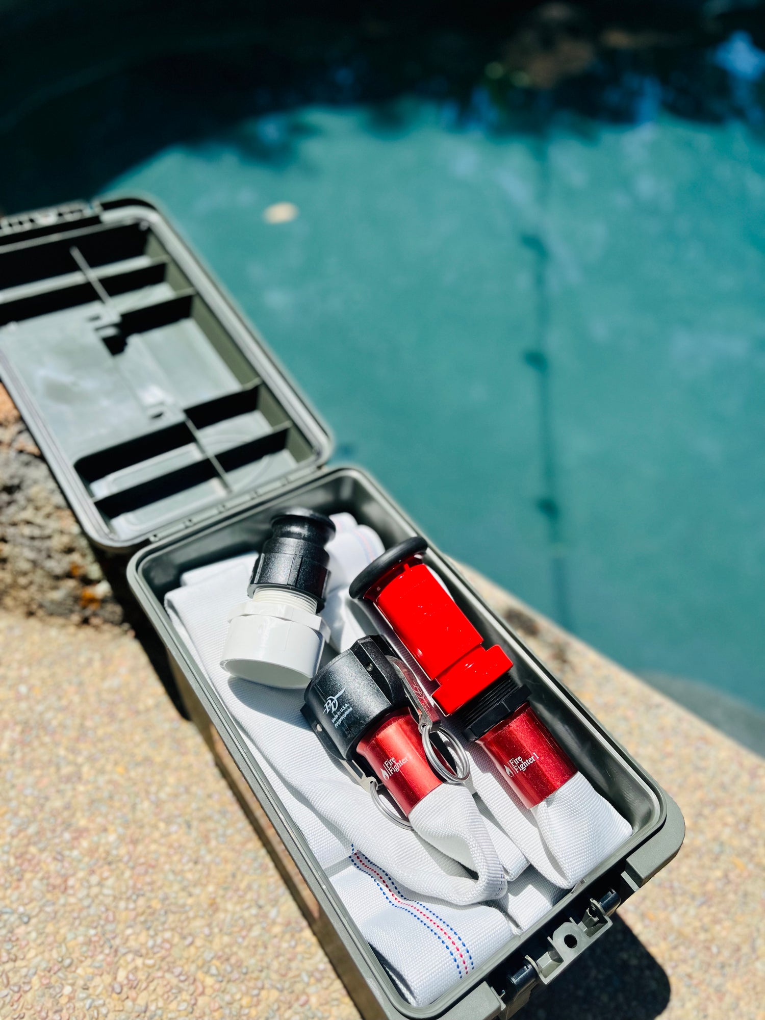
Your Pool Is Your Neighborhood's Best Defense
FireFighter1™ turns your existing pool into a 10,000–15,000 gallon fire suppression system. Be ready before fire arrives.